Marine And Freshwater
Landscape-Scale Mapping in Difficult Environments
A UNIQUE PROPOSITION
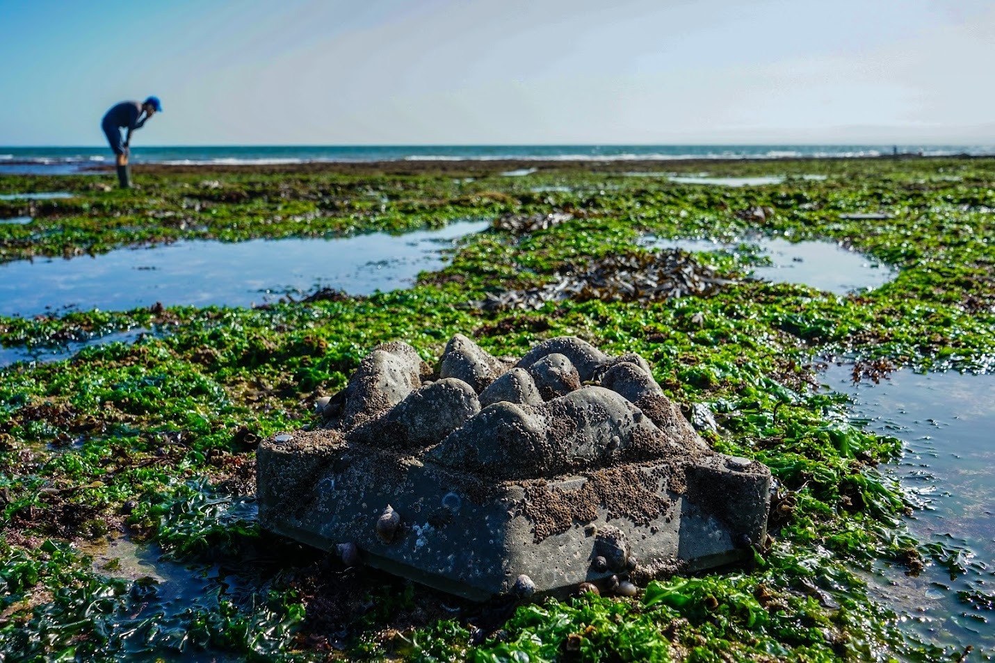
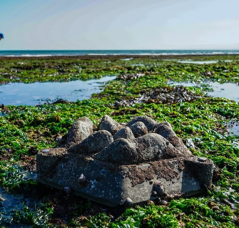
Marine and aquatic habitats are often overlooked. Water makes access difficult, species are difficult to identify, specialists are fewer and further between than in terrestrial habitats. Mapping these environments has been difficult, time-consuming, costly and typically low resolution or at small scales. Until now.
We are experts in the marine and freshwater environments, with over a decade of experience identifying species in these highly diverse systems, as well as mapping and understanding the ecology, ecosystem services and environmental drivers in coastal marine and riverine systems. Whatever your need, we have you covered.
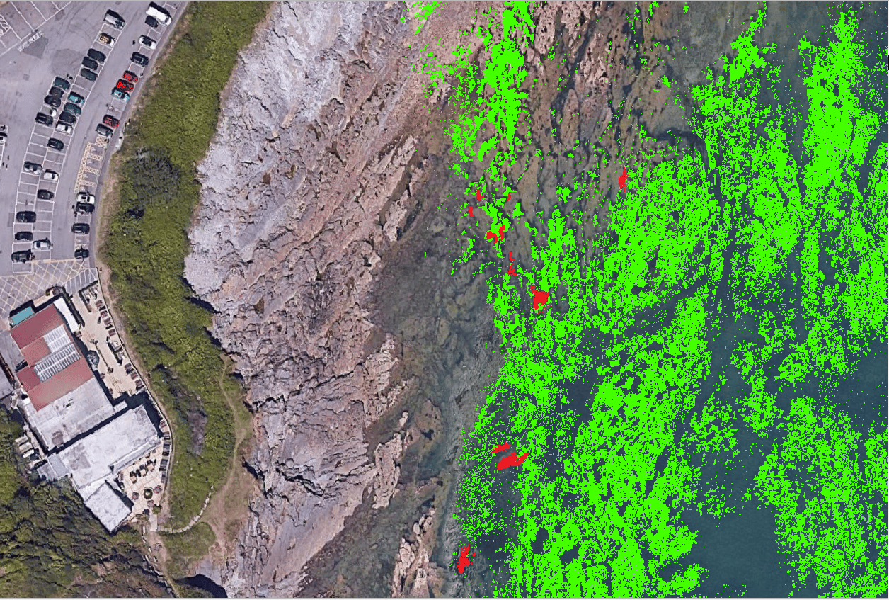
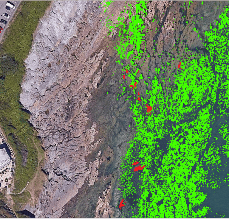
MAPPING ALGAE AND REEFS
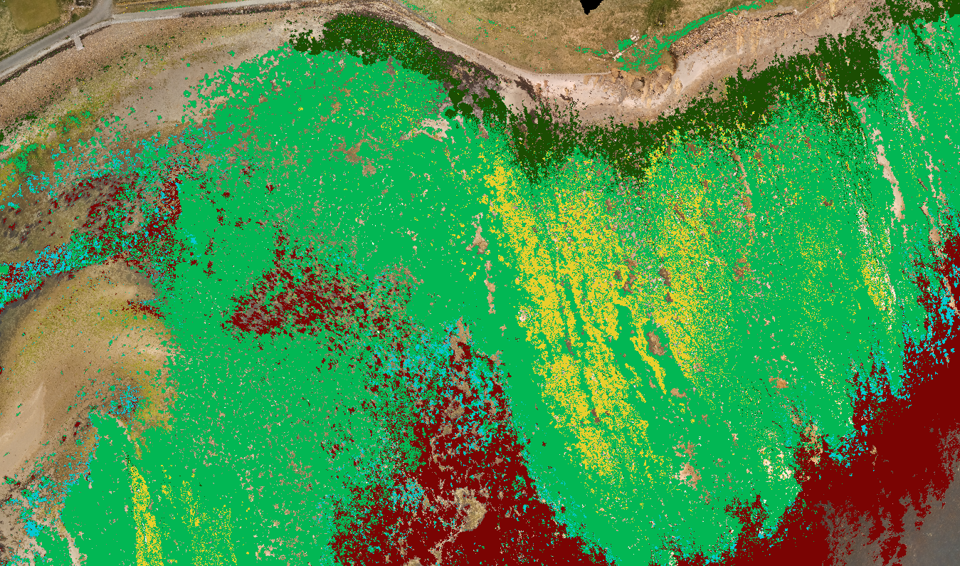
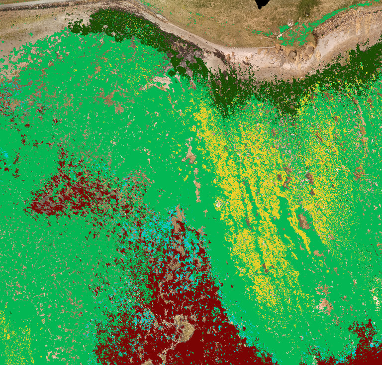
We are uniquely able to offer species-level mapping of habitat-forming intertidal marine organisms; including many seaweed algal species, mussels, oyster reefs, Sabellaria reefs, and other key indicator species, at coastline scales using our advanced multispectral and machine learning mapping techniques.
In addition to UAV and satellite large-scale surveying, we can also offer in-depth traditional field surveying services, providing full biodiversity censuses for algal, invertebrate and vertebrate species at local shore scales.
We also offer research and development support for regulators, academic institutions, and businesses looking to push the boundaries of environmental monitoring and mapping.
MONITORING CHANGE
Detecting changes in distributions of marine species is essential for managing impacts from development or environmental pressures, especially for large infrastructure projects. This is especially acute in these highly connected ecosystems, where impacts may be felt wider than they would in terrestrial habitats.
We can support your monitoring projects by providing large-scale, very high resolution mapping of key habitat forming indicator species, allowing us to detect changes accurately and mitigate against them across whole coastlines.
We can offer monitoring of pre- and post-development impacts and habitat change across seasons or years. Our monitoring services help clients stay ahead of environmental risks, respond quickly to emerging threats, and ensure regulatory compliance
MULTI-MODAL MAPPING
Understanding impacts of human activities and monitoring change is even more important in highly connected systems like rivers, coasts and estuaries. In these environments, small changes, or negative consequences of discharges can affect organisms hundreds of kilometres away.
Unlike other consultancies, we specialise in multi-platform mapping, including shallow stream bathymetry from LiDAR, algal and aquatic plant mapping using UAVs and traditional in-water surveying for benthic organisms. We can also offer cross-biome and cross-disciplinary services, coupling flows of services across terrestrial, riparian and aquatic habitats, or undertaking combined hydrography-ecology studies that capture the mechanisms and drivers of change, allowing more holistic management of challenges in our natural environment.
From creating wetlands, to development activities, to abstraction licences, understanding how changes can affect the physical environment, and how these changes can alter the ecology is critical to ensure a healthy environment for generations to come.
Bespoke Research
Have a particular problem you need to solve? With decades of experience in cutting-edge ecological research, our team can help you achieve your goals. Whether establishing the credentials of your new eco-engineering solution by monitoring positive effects on biodiversity and ecosystem functions/services, or creating a new platform for monitoring invasive species, we have the tools and the expertise to make it work.
CONTACT US
For the Past Decade, we’ve been obsessed with pushing the boundaries of ecology and mapping, and with Spectral Ecology we are finally opening up cutting-edge science to a wide gamut of users. Talk to us today to see how we can revolutionise your ecological and mapping needs.


Spectral Ecology Limited - Registered in England and Wales: 6386647 VAT Number: 496380548 Email: tom.fairchild@spectralecology.com