

Invasive Species (INNS)
Go beyond the visible spectrum with our advanced UAV-derived multispectral and hyperspectral mapping - with exceptional detection of Invasive Species at whole landscape scales.
Mapping Invasive Species
Managing invasive non-native species (INNS) is a critical environmental priority; missing even a single remote plant can lead to rapid regrowth and further spread. While traditional ground surveys are vital, they struggle in dense, inaccessible terrain and often miss small individuals hidden within native vegetation.
At Spectral Ecology, we deploy our proprietary spectral mapping techniques to locate invasive species with unprecedented accuracy. Operating at spatial resolutions as fine as 5cm, our models can isolate small individuals mixed within dense native stands—a level of separability unmatched by standard remote sensing. Our technology complements ground teams, ensuring complete coverage across bogs, briar, and challenging landscapes, while delivering actionable data directly to your contractors.
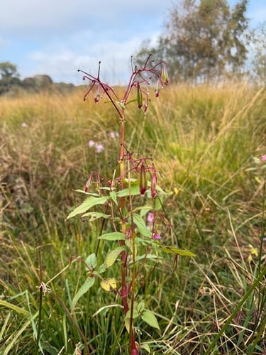


Detect isolated plants and hidden individuals within mixed native stands at resolutions up to 5cm, ensuring complete treatment and preventing costly regrowth.
Outstanding Detection
Safely and rapidly map impenetrable terrain. Dense briar, deep bogs, and hazardous slopes pose no access hindrance to our advanced enterprise UAVs.
Safe Access
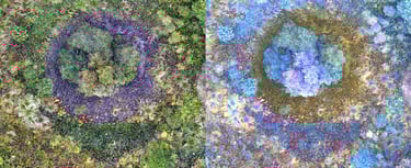
Cover and Biomass
Actionable Management
Go beyond mere identification. We accurately calculate percentage cover and model total biomass from cover and LiDAR heights to inform highly efficient, targeted management and treatment strategies.
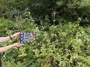
We deliver practical, phone-GPS-ready grid maps (1-5m cells) designed for ground teams. Loaded with biomass and density data, these maps enable your specialist eradication contractors to calculate precise treatment dosages.
We offer world-leading invasive species mapping and modelling services, featuring:


Spectral Ecology Limited - Registered in England and Wales: 16386647 VAT Number: 496380548 Email: tom.fairchild@spectralecology.com © Spectral Ecology limited (2026)